 The United Nations General Assembly’s 4 September 2026 vote on “Correct the Map” has generated considerable discussion about the future of global cartography. For Kashmir, however, its significance lies less in the projection used to represent the world’s continents and more in what the United Nations did not change: its established cartographic treatment of the disputed status of Jammu and Kashmir.
At the 114th plenary meeting of the 80th session, the General Assembly adopted draft A/80/L.104, subsequently issued as A/RES/80/307, by an overwhelming 164 votes in favour, one against and six abstentions. The resolution addresses distortions in conventional world-map projections, particularly the disproportionate visual representation of continents, and encourages the use of Equal Earth and other equal-area projections where appropriate. It does not redraw international boundaries, settle territorial disputes or determine sovereignty over disputed territories.
This distinction is crucial: the 164 votes were not votes specifically to declare Kashmir’s disputed status or to ratify the status quo; they were votes on a global cartographic question. Yet the significance for Kashmir lies in the fact that the resolution maintains the United Nations’ existing framework for representing disputed territories.
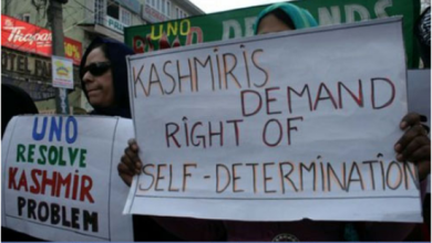
The most direct evidence is the UN’s own Map No. 4668, Jammu and Kashmir, published in 2023 by the UN Geospatial Information Section. The map does not endorse India’s political map of Jammu and Kashmir. Instead, it distinguishes the Line of Control from an international boundary and, most importantly, carries the explicit statement: “The final status of Jammu and Kashmir has not yet been agreed upon by the parties.”


The map further states that the dotted line represents approximately the Line of Control in Jammu and Kashmir agreed upon by India and Pakistan, while the standard UN disclaimer makes clear that the boundaries and names shown do not imply official endorsement or acceptance by the United Nations.
This is not a minor cartographic detail. In disputes, the manner in which a boundary is represented can carry profound political and legal significance. An international boundary denotes an accepted frontier between sovereign states, whereas a Line of Control represents a line separating areas under the control of the parties without itself determining final sovereignty. That distinction remains embedded in the UN’s treatment of Kashmir.
It becomes particularly significant after 5 August 2019, when India unilaterally altered the constitutional and administrative structure of the territory under its control, abrogated the special constitutional provisions associated with Articles 370 and 35A, and subsequently reorganised the former state into two Union Territories. India may have changed its domestic constitutional and administrative arrangements, but a unilateral domestic act cannot, by itself, rewrite the international status of a disputed territory.
The United Nations’ cartographic record has not adopted India’s post-2019 constitutional map as an internationally settled position. Instead, the UN continues to describe the final status of Jammu and Kashmir as unresolved and continues to distinguish the Line of Control from an international boundary. This continuity is particularly important because it demonstrates that India’s unilateral constitutional reorganisation has not automatically transformed Kashmir into an internationally settled matter.
The 2026 “Correct the Map” resolution therefore needs to be understood within its actual scope. Its objective is to promote greater accuracy and fairness in the geographical representation of the world, particularly by addressing distortions in the apparent size of continents. It does not empower any state to transform a unilateral political claim into an internationally recognised boundary.
India’s vote in favour of the resolution, therefore, cannot logically be converted into General Assembly endorsement of its post-2019 political map of Jammu and Kashmir. India voted on the global cartographic resolution and, therefore, cannot be selective in interpreting its implications. Likewise, Pakistan’s vote presented and reaffirmed its official stand on Kashmir’s disputed status.
The real significance lies in continuity: the United Nations has sought to correct aspects of the visual representation of geographical space, but it has not altered Kashmir’s unresolved political status. Nor has the resolution converted the Line of Control into an international boundary.
For India, this creates a fundamental diplomatic limitation. New Delhi may claim domestically that the constitutional question has been settled; it may publish maps reflecting its own constitutional and administrative arrangements; and it may seek to project those maps internationally. But an internally adopted map is not automatically an internationally accepted map.
At the United Nations, the relevant cartographic record continues to distinguish the Line of Control from an international boundary and continues to state that the final status of Jammu and Kashmir has not yet been agreed upon by the parties.
The 4 September vote, therefore, should neither be exaggerated nor misrepresented. It was not a 164–1–6 vote on Kashmir, but equally, it was a vote that rejected India’s unilateral post-5 August 2019 territorial narrative. The established UN cartographic framework remains intact.
For the international audience, the message is straightforward: India may change its domestic constitutional map, but it cannot unilaterally change the United Nations’ international cartographic record. It may reorganise the territory under its control, but such action does not by itself transform a disputed territory into an internationally recognised part of India.
The most authoritative evidence is therefore not an Indian political map, a Pakistani counter-map, a newspaper headline or an interpretation from either side, but the language printed on the United Nations’ own Map No. 4668: “The final status of Jammu and Kashmir has not yet been agreed upon by the parties.”
That formulation carries a powerful diplomatic message. Kashmir remains an unresolved international dispute in the UN’s own cartographic record, and India has no unilateral option to present its post-2019 constitutional arrangements as a settlement before the United Nations or the wider international community.
The world may correct the way geographical space is visually represented, but no unilateral cartographic exercise can convert a disputed territory into settled international territory. India can change its map unilaterally, as it has done since 1947; it cannot, by itself, change the UN’s position.
The countries that voted on the resolution should use their good offices to influence India to correct its map of Kashmir, which remains a disputed territory. Therefore, Kashmir’s disputed status cannot be corrected away through unilateral cartography, but only through the UN mechanism as per the UN template.