India’s pollution crisis exposed by satellite data, report challenges blame on Pakistan
NASA, other satellite records reveal crop fires, industrial emissions across India
Islamabad : Satellite imagery and scientific studies have highlighted India’s mounting pollution crisis documenting widespread crop fires, industrial emissions and persistent haze.
The evidence also raises questions over attempts to shift blame on Pakistan. Some Indian media reports have highlighted pollution from Pakistan. However, Indian data also document substantial domestic pollution sources.
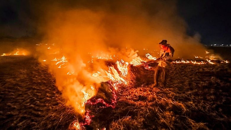


A Hindustan Times analysis, published on November 2, linked Delhi’s latest pollution spike to farm fires in Punjab and Haryana. It examined air-quality readings, weather conditions and satellite observations.
Delhi’s Air Quality Index (AQI) rose from 117 to 261. It reached 324 on November 2, entering the “very poor” category. Overnight PM2.5 averaged 194 micrograms per cubic metre. This exceeded India’s daily limit of 60 micrograms. The analysis found that many fires started after 3pm.
 NASA’s polar-orbiting satellite passes over Punjab around 1:30pm. Consequently, it may miss many evening fires. India’s INSAT-3DS satellite detected an evening increase. Its recorded fires rose from 17 on October 29 to 90 on November 1.
Crop burning adds to India’s pollution burden
Indian Council of Agricultural Research (ICAR) data recorded 3,316 fires. These occurred across seven states between September 15 and November 1. Punjab accounted for 1,514 incidents, the highest state tally.
Rajasthan recorded 671, followed by Madhya Pradesh with 566. Uttar Pradesh reported 345, Uttarakhand 176 and Haryana 42. Delhi recorded two incidents during the period.
The figures underline the continuing challenge of crop-residue burning. Satellite observations also show changing patterns of fire activity. The timing of fires can affect detection by individual satellites. Therefore, a lower count from one satellite cannot establish reduced burning.
Brick kilns and industrial emissions
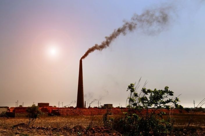
Industrial sources also contribute to India’s year-round pollution. A 2026 study mapped brick kilns using Sentinel-2 imagery. Published in the International Journal of Applied Earth Observation and Geoinformation, it mapped 48,928 kilns for 2025. Researchers said the mapping could support pollution monitoring. It also identified changes in kiln distribution and technology.
Separate reporting on the research estimates over one million kilns nationwide. It says the industry consumes around 35 million tonnes of coal annually. These estimates highlight the sector’s potential environmental footprint. However, the research paper’s mapped count is 48,928 kilns.
Coal-fired power plants and factories add further pollution. The Centre for Research on Energy and Clean Air (CREA) has examined secondary particulate matter. Its analysis found ammonium sulfate contributes substantially to PM2.5 pollution. It accounts for up to 42 percent in some states. This pollutant forms in the atmosphere from precursor gases. Sulphur dioxide emissions are a major contributor.
The 2025 IQAir report recorded annual PM2.5 of 101.1 micrograms. This figure was reported for Byrnihat, a major industrial area. It ranked among the world’s most polluted urban locations.
Satellite imagery
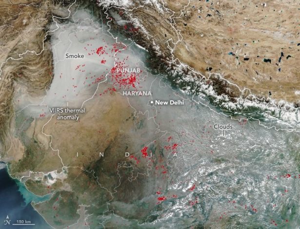
The European Union’s Copernicus programme released satellite imagery on November 2. The Sentinel-3 image was acquired on November 1. It showed smoke and haze stretching across the Indo-Gangetic Plain. The visible haze extended from around Lahore to New Delhi. Copernicus identified agricultural burning, urban and industrial emissions. It also cited weather conditions limiting pollutant dispersion.
NASA’s Earth Observatory has also documented crop-burning activity. Its imagery shows fires and smoke across northwestern India. NASA observations explain how fire activity changes seasonally. They also illustrate the regional spread of smoke.
Meanwhile, Indian media reports have highlighted crop fires in Pakistan. One report cited satellite detections in Pakistan’s Punjab. It suggested these fires could aggravate Delhi’s pollution. However, the report also acknowledged an important limitation. Fire counts alone cannot establish their contribution to Delhi’s pollution.
The evidence points to a regional pollution problem. It requires transparent monitoring and cooperation between neighbouring countries. India must also address its own documented emission sources. Crop burning, industrial pollution and coal emissions need effective controls. Shifting blame cannot replace environmental action and accountability.