Glacier-rock collapses pose flood threat in IIOJK, warn experts
Srinagar: Experts have warned that glacier-rock collapses can trigger destructive floods without a glacial lake, calling for urgent geological mapping of unstable high-altitude slopes in Indian illegally occupied Jammu and Kashmir.
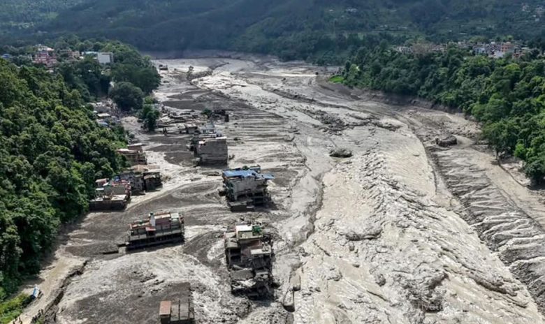
According to reports, the August 26 flash floods along the Nepal-Tibet border were initially linked to a Glacial Lake Outburst Flood (GLOF). However, satellite analysis by ICIMOD showed it was a high-magnitude ice-rock avalanche that entered Lende Khola and turned into a debris flood.
Riyaz Ahmad Mir, scientist at NIH’s Western Himalayan Regional Centre in Jammu, said the failure occurred in an area with warm permafrost and fractured bedrock. “The failure entrained large volumes of glacier ice, snow and loose debris. It rapidly moved downstream and transformed into a highly destructive debris flood,” he said. Mir said Himachal Pradesh, the Chenab Valley in Jammu – Kishtwar, Doda and Ramban – and Ladakh should be prioritised for detailed geological assessment, followed by Kashmir. He noted Kishtwar is the main hotspot in Chenab valley and faces high risk from both glacier-related hazards and GLOFs.

Prof Ghulam Jeelani, Dean at University of Kashmir, said glacier-rock collapses and GLOFs are separate processes. “An ice-rock avalanche can enter a river channel, pick up water, sediment and boulders and develop into a destructive debris flood. It can also strike a glacial lake and trigger a GLOF,” he said.
A recent study identified the Western occupied Jammu and Kashmir and Himachal as the most climate-sensitive sector, with about 1°C warming since the early 20th century. Under high-emissions scenarios, winter temperatures could rise by 7.18°C by 2081-2100.
Another University of Kashmir study of 155 glacial lakes in Kashmir flagged Bramsar, Chirsar, Nundkol, Gangbal and Bhagsar as having “very high” GLOF susceptibility, with 2704 buildings and 15 major bridges in impact zones.
Experts said risk assessment must go beyond glacial-lake inventories to include glaciers, rock slopes, permafrost and downstream channels. They called for real-time monitoring and early-warning systems in areas prone to sudden slope failures.